
Conservation Crop Rotation – 328
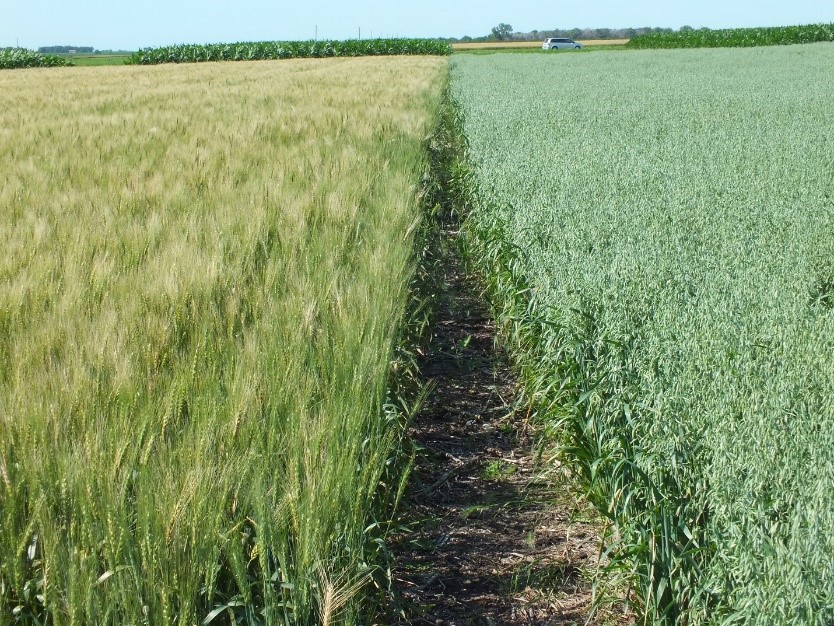
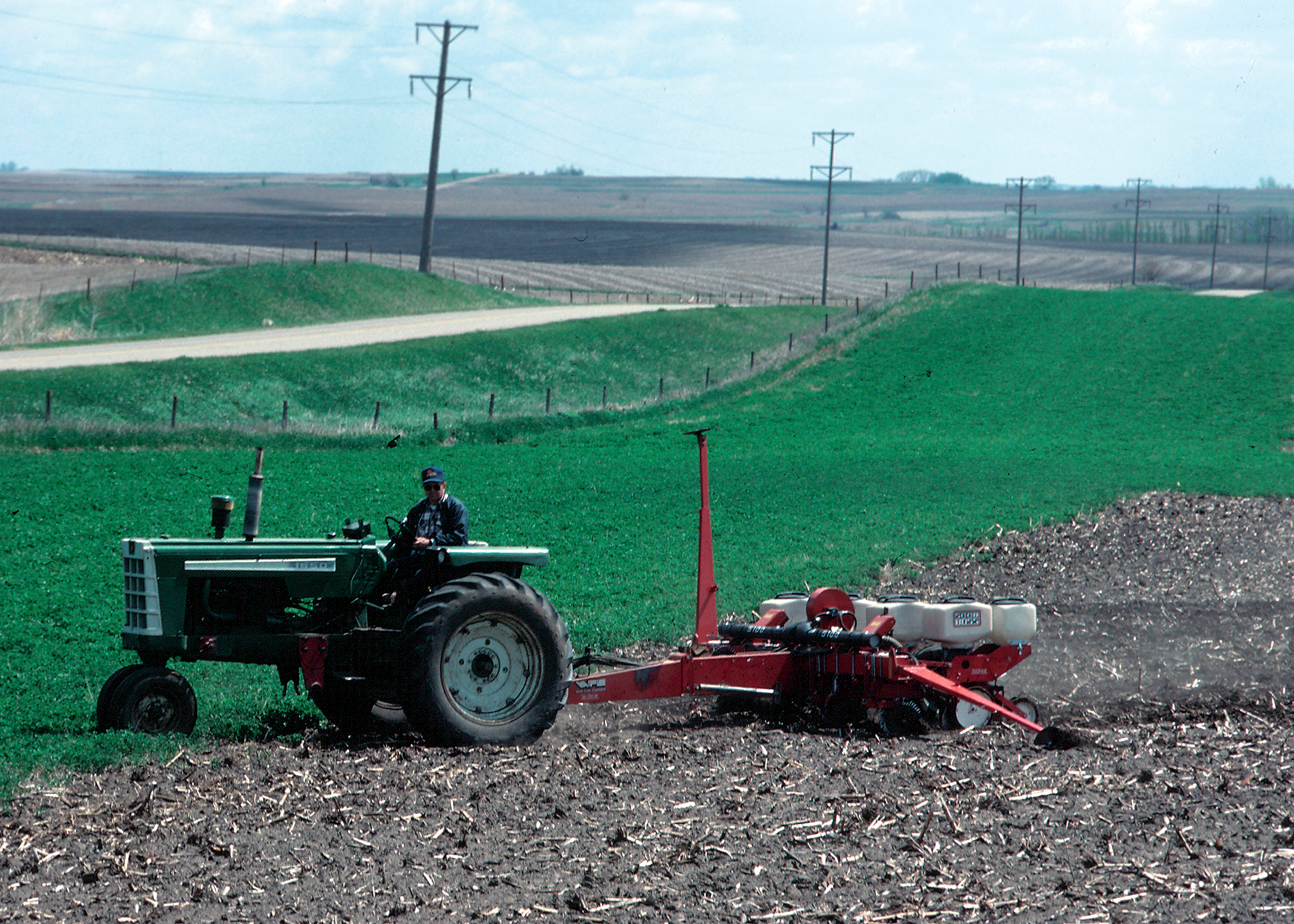
A conservation crop rotation is a planned sequence of at least two different crops grown on the same ground over a period of time. It is a fundamental agronomic practice that reaps a long list of benefits, of which many have been recognized for centuries. Simply put, actively growing crops limit wind erosion because wind velocities at the soil surface are kept below the thresholds that cause creep and saltation. Crop rotation can be considered the umbrella practice that numerous others build from, such as Cover Crops (340), Residue Management (329, 345), Nutrient Management (590), and Integrated Pest Management (595). The chief benefit is marked increase in production, making it relatively acceptable to most farmers. For example, a thirty-year study conducted at Penn State54 evaluated continuous corn versus short-term and long-term corn rotations. Corn/Soybean outperformed continuous corn, and corn in rotation with two-year and three-year alfalfa cycles outperformed corn/soybeans.
NRCS utilizes the Soil Conditioning Index (SCI) to evaluate the adequacy of the crop rotation. The SCI is embedded in all NRCS erosion prediction tools, including the Wind Erosion Prediction System (WEPS), Water Erosion Prediction Project (WEPP), Revised Universal Soil Loss Equation -2 (RUSLE2), and the Integrated Erosion Tool (IET). The SCI rates an individual Conservation Cropping Rotation based on the system’s effects realized from tillage, residue use, and added mulches. The rating is based on three subfactors - organic matter buildup or depletion, tillage effects to residues and compaction, and predicted erosion rates. A positive rating indicates that the employed system is building organic matter in the soil, sequestering carbon, and is a sustainable long-term cropping system. A negative rating would indicate the system is depleting organic matter and would have some long-term production limitations. For more information on the SCI, see Appendix B, Exhibit 6-2.
However, there are certain areas across the country where mono-cultures are practiced. In arid and semi-arid regions where dryland farming exists, soil moisture is such a critical limiting factor that growing anything but drought tolerant grains is highly risky. If the plant residues are properly managed, this is an acceptable cropping system. In much of the West, development value of land exceeds the farming value of the land. Where this occurs, investor speculation prompt landowners to rent farmland out to the highest bidders on short-term leases, while the investor can maintain the lower agricultural property taxes. Farmers leasing these lands are apt to farm the most profitable cash crop prevalent in the area rather than invest in soil building crops, not knowing when they may lose the lease. In these cases, the same crop may be grown year after year, reducing the profitability of the land and negatively impacting soil health. These lands can be high risk areas for wind erosion.
Nearly all crop rotations will have some value to the soil health, structure, or fertility, and even the simplest two-crop rotations will return fewer greenhouse gases to the atmosphere than monocultures.55 However, most rotations are designed around either improving soil fertility or organic matter content in the soil, or both. Legumes, such as alfalfa, clover, vetch, peas, and beans, improve soil fertility through their ability to fix nitrogen in the soil to render it readily available for the next crop. This reduces the need to buy nitrogen fertilizer, a key macro-nutrient for all plant growth. High biomass crops, needed to improve organic matter in the soil and general soil health, are typically grasses and grain crops, such as wheat, barley, oats, sorghum, and rye. This organic matter is critical in developing a soil that is resistant to wind erosion. Additionally, high biomass rotations will sequester carbon and reduce greenhouse gas emissions responsible for climate change.
With farmers facing the impacts of climate change nation-wide, it is becoming clear to many growers that, in selecting the right crop rotation, “business as usual” can be fraught with peril. Across the West, many surface water supplies in rivers and reservoirs are diminishing. In the West, water rights often exceed water availability in many areas. Compounding the water shortage problem, some key groundwater aquifers are depleting, causing wells to become less productive. Farmers are making difficult decisions to maintain their production system viability, for example, whether to invest in expensive improvements to their wells, or in higher efficiency irrigation systems. Beyond that, they should be considering changes to their crop rotations that reduce their dependency on water, build more resiliency to wind and water erosion, and improve infiltration rates so that water from high-intensity rainfall can be more readily absorbed into the soil.
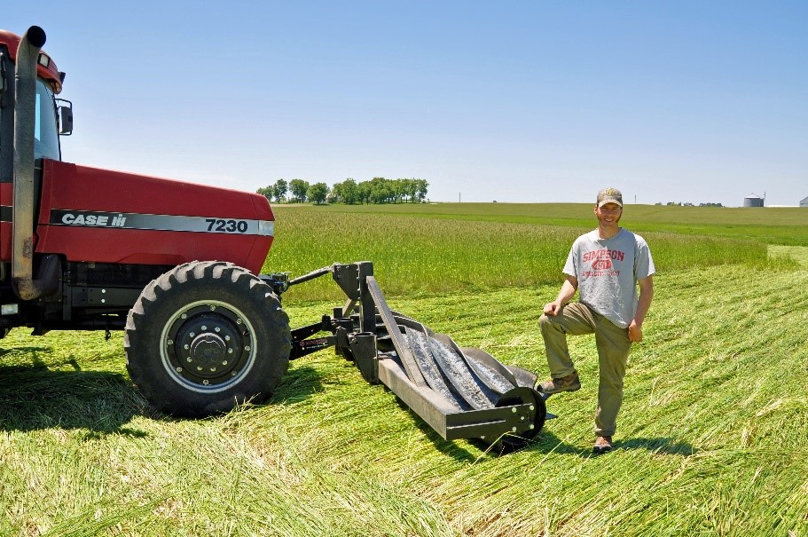
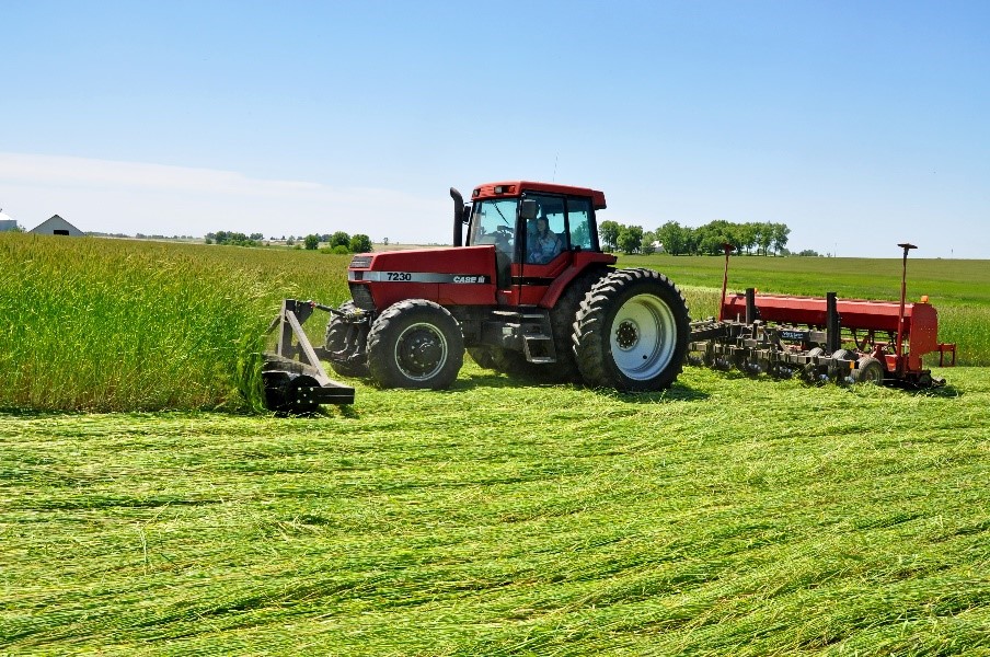
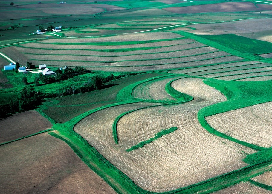
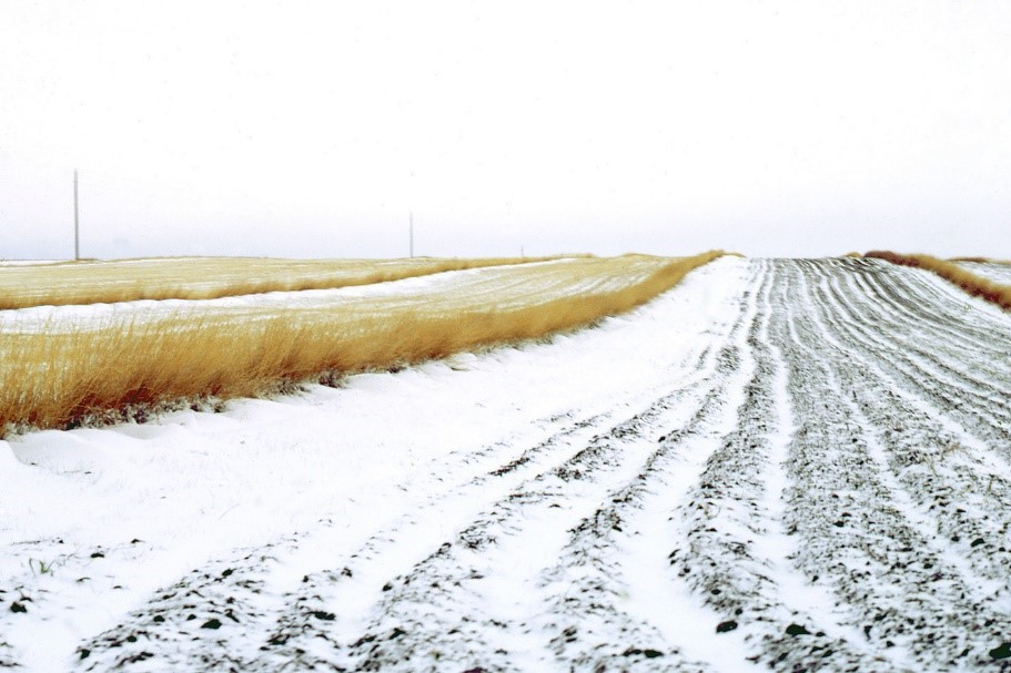
Double-cropping, sometimes also called multi-cropping, is a system where two harvested crops are produced during the growing season. This is most easily accomplished in the southern parts of the country where the growing season is long enough to accommodate two crops, and usually involves the growing of a cool season grain crop. Double-cropping is made easier when coupled with a version of reduced tillage to shorten preparation times between both crops. Double-cropping is an excellent way to reduce wind erosion. Fields are covered with a growing crop most of the year, and the time when fields are most vulnerable between crops is shortened because the farmer is pressed to meet planting windows for optimum yields.
Alfalfa is excellent at building soil health and improving infiltration rates and soil fertility, but it also has a high water requirement. In areas where water supplies are not dependable, crop rotation considerations should include warm and cool season crops that fix nitrogen, have high biomass potential per unit of water, and - when water suddenly becomes unavailable - plant residues that are sufficient to keep the soil in place for an extended period of time. Producers should consult agronomic professionals to determine which crops are feasible alternatives for their specific area.
Residue and Tillage Management, No Till – 329, and Residue and Tillage Management, Reduced Till – 345
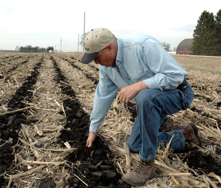
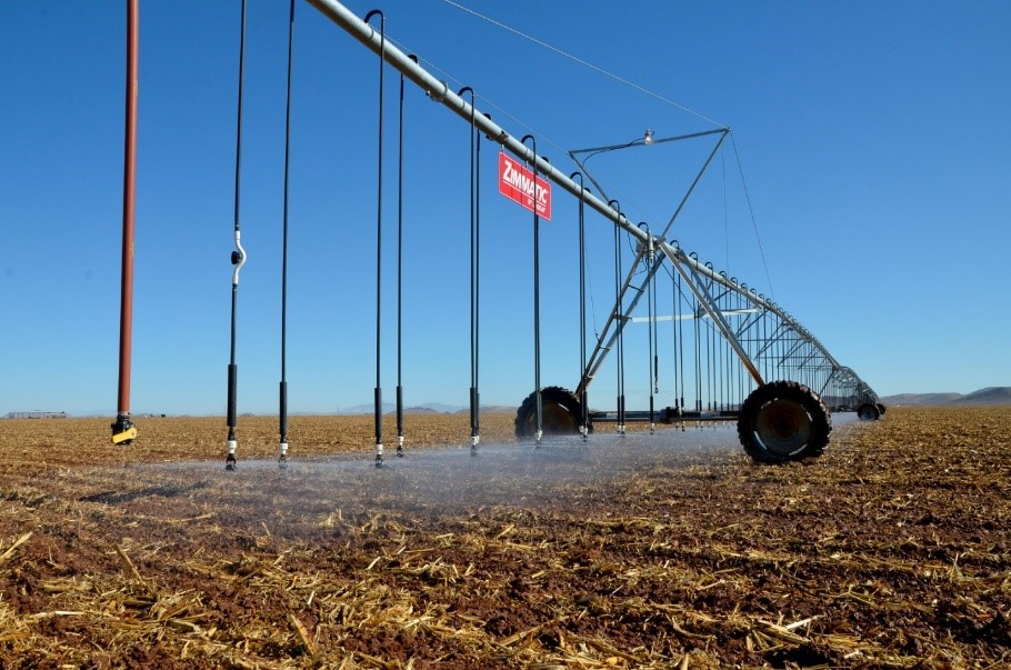
These practices are highly effective in controlling wind erosion. Where significant crop residues are left on the soil surface, the creep and saltation processes of wind erosion are vastly reduced. Additionally, these residue management systems improve organic matter content in the first six inches of soil. The soil macro and micro-fauna break this organic matter down to humus, which is the “glue” that holds soil particles together in stable aggregates that resist dislodging by the forces of wind. Residues on the surface also moderate soil temperature and conserve soil moisture that contribute to sustainable and resilient farm fields.
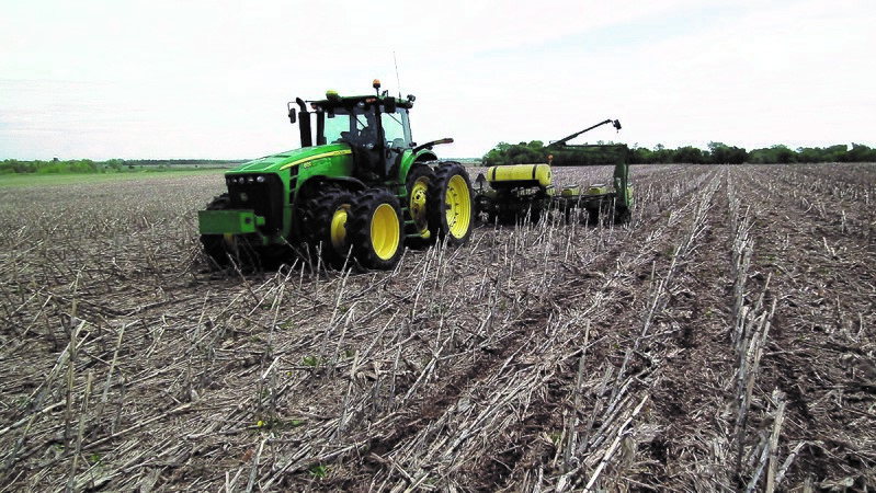
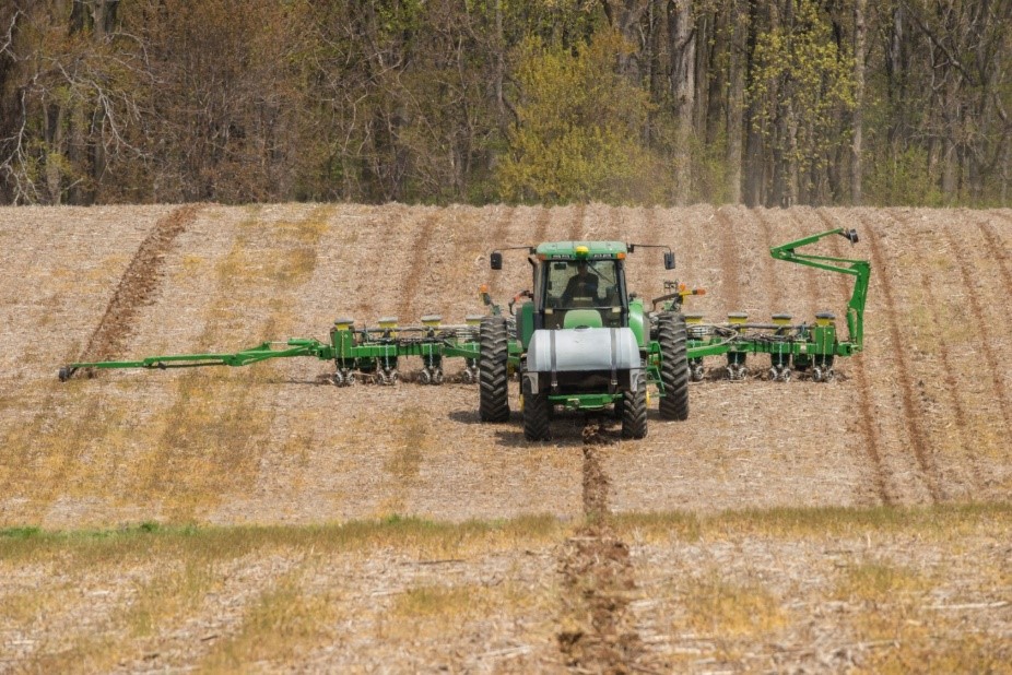
Over the last few decades, numerous variations of conservation tillage equipment were developed. Hence, NRCS naming conventions for the various systems had also changed. In the “farm ugly” days of the 1970’s and 1980’s, no-till systems were being marketed and encouraged as alternatives to the moldboard plow and other conventional tillage systems. Most of the early no-till systems involved direct seeding into the previous crop’s residue. As a result, it was typically easy to tell when a farmer was utilizing a no-till system or conventional tillage. Any system that used variations of conventional tillage that left appreciable amounts of residues on the surface was simply referred to as “minimum tillage.” As time went on, tillage systems became more complex, with many variants leaving almost as much residues on the surface as no-till. NRCS kept up with these advancements and established practice codes and definitions for mulch till, ridge till, and strip till, while still recognizing no-till and other minimum till systems. Tillage systems have continued to evolve, and differentiating between the systems has become increasingly difficult. Thus, NRCS recently established only two practice codes. No-till (329) accounts for all direct-seeding systems into the previous crop’s residues and all strip till systems that have a Soil Tillage Intensity Rating (STIR) no greater than 20. Reduced Till (345) accounts for all systems, including mulch, ridge, and conventional, that reduce traffic in the field and have a STIR no greater than 80. Reduced Till is also sometimes referred to as “conservation tillage.”
Although amounts of residues are not specifically detailed in the practice criteria, no-till generally leaves about 60 to 70 percent of the soil surface covered by residue, while reduced till leaves no less than 30 percent of the surface covered. By definition, neither No-till nor Reduced Till can utilize residue inversion, such as a plow. The STIR is calculated within the erosion modeling software currently employed by NRCS, including the WEPS and the WEPP. STIR values can also be calculated using the Revised Universal Soil Loss Equation, a system currently being phased out of NRCS.
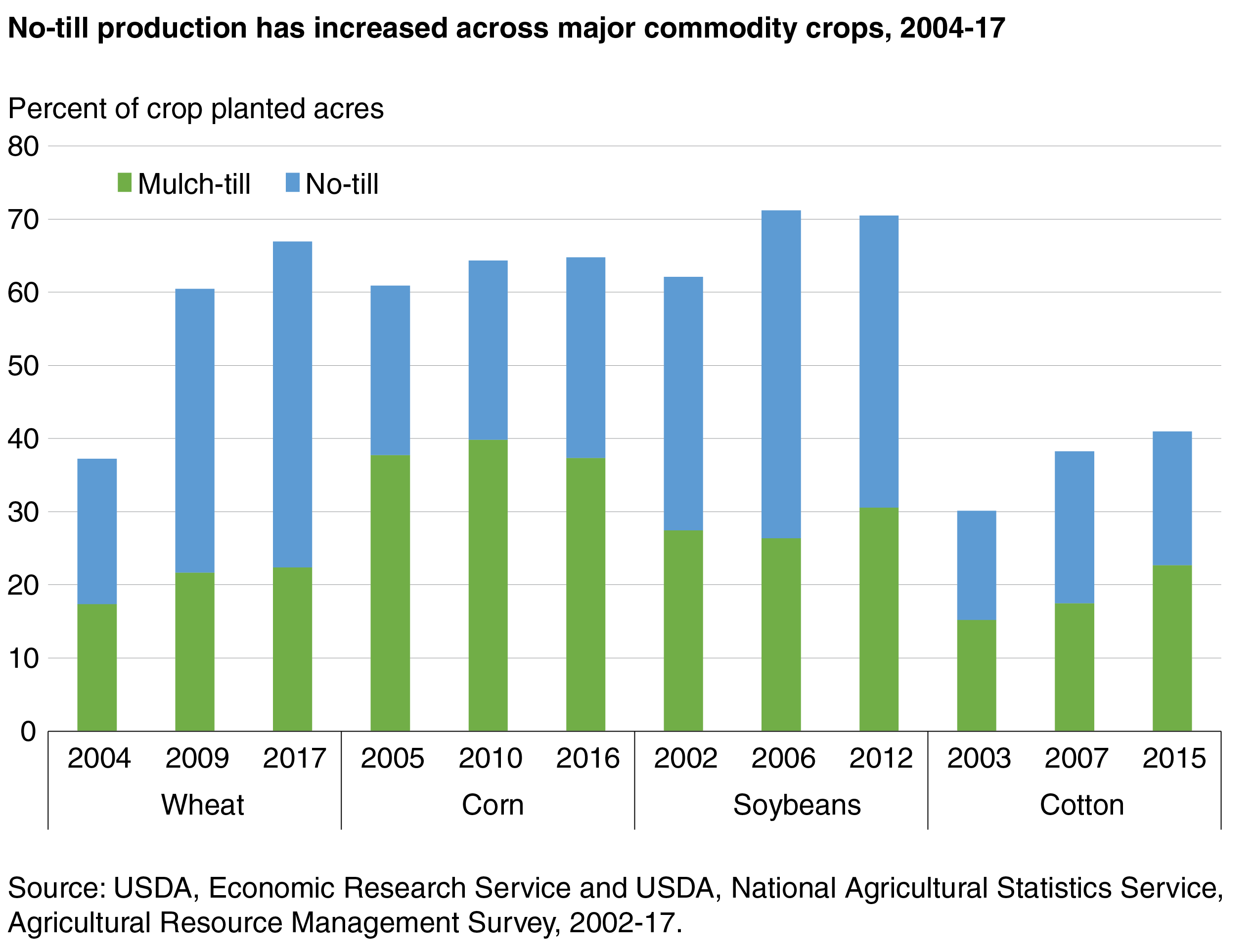
Advantages of no-till and reduced-till systems are profound, especially in the context of variable and changing weather and climate conditions. A major advantage of No-till and Reduced Till is the vastly reduced energy inputs needed to prepare the land from one crop to the next. With slim margins for agricultural commodities and unstable energy prices, it behooves the farmer to consider tillage systems that cost less to implement. The 2017 Census of Agriculture, released by the National Agricultural Statistics Service in April 2019, estimated that 37% of America’s tillable cropland were utilizing no-till systems, and another 35% of American farmland is reported to be utilizing some form of reduced tillage.56 This means that approximately 72% of U.S. farmland is under no-till or reduced-till. This is an increase from the estimated 62% of farmland under no-till or reduced till reported in the 2012 Census of Agriculture.57 Naturally, adoption is varied by region and crop; Figure 6-11 summarizes the Economic Research Service’s study on adoption of no-till by crop.
Adoption of No-till and Reduced Till is hampered in some regions of the country by the production systems used and food safety concerns. In those areas where surface irrigation is prominent, early adopters admit a steep learning curve when dealing with large amounts of crop residue on the soil surface. Furrows tend to clog with debris leading to bed failure and some rows receiving too much water and leaving other rows dry. Additionally, after several years of reduced till, the infiltration rate increases, and irrigators find it difficult to get the water down the complete furrow. Farmers in turn need to adjust set sizes, set times and flow rates to accomplish efficient irrigation. This can take years of tinkering before adequate solutions are discovered. Another option is to convert the irrigation system to level basins and plant on the flat or convert to sprinkler or drip irrigation. Leased land can compound this dilemma, as each field will respond differently based on soils and other conditions. Farmers do not want to spend time or money “figuring it out.”
Also, in intense food production systems that include vegetables and fruits, industry standards are calling for clean till systems out of concern for food safety. Where residues are present, wildlife are attracted to the fields, which raises concern for contamination by E. coli and other pathogens. These are high dollar food production systems where contamination of one field can cost the grower millions of dollars.
Cover Crops – 340
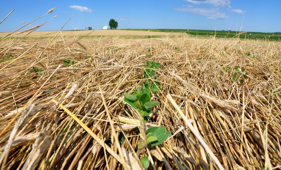
Cover Crops are an extremely effective means of controlling wind erosion during otherwise fallow portions of a cropping rotation. In fact, cover crops are gaining popularity as a routine component of the cropping system. Cover crops also play a role in improving organic matter content, managing soil and temperature, suppressing weed growth, providing nutrient enrichment (where leguminous cover crops are used), interrupting plant pest cycles, mitigating soil compaction, and providing cover and food for wildlife. Their value to natural resource conservation cannot be understated.
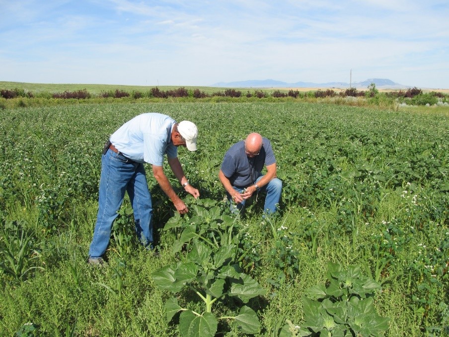
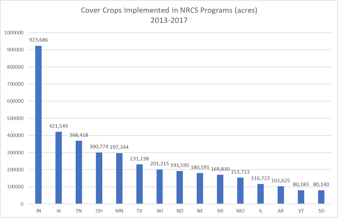
Cover crops are the most popular erosion control practice in NRCS programs, both in number of contract line items as well as dollars expended. Programmatically, implementation of Cover Crops incentivizes the farmer to examine the benefits of the practice with little financial risk. However, the USDA Economic Research Service has estimated that only 2% of the nation’s cropland utilizes cover crops. This low number may reflect producer reluctance based on unfamiliarity with the practice, its economics, shortened windows for the cash crop, and lack of equipment to properly handle green manure crops or heavy residues. Also, in semi-arid, dryland farming areas, soil moisture depletion by a cover crop has been shown to be detrimental to the subsequent cash crop’s yield.60 In irrigated areas, the cost of irrigation water to grow a crop that will not be harvested can also be a concern. To assist in determining whether a cover crop can be supported economically, an Excel-based Cover Crop Economics Tool61 has been developed. The NRCS webpage for the tool62 also features a video demonstrating the tool's use; a fact sheet explaining the tool is included in Appendix B, Exhibit 6-3 of this handbook.
Because growing a cover crop in low rainfall, dryland farming areas can negatively impact yield of the cash crop, the USDA Risk Management Agency (RMA) has established rules for planting cover crops in fallow periods when insuring the cash crop. It is critical to understand these rules in order to not jeopardize crop insurance payouts. General information can be found on the RMA's website under 2020 Cover Crops Insurance and NRCS Cover Crop Termination Guidelines63 and also under the topic Cover Crops,64 but farmers should consult their local NRCS, RMA, or Cooperative Extension agent to understand how best to incorporate cover crops into their crop rotation.
Cover crops are not typically harvested, and where increasing organic matter in the soils is a concern, they are not grazed or baled for hay. Some USDA programs restrict these activities; again, producers should contact their local NRCS, FSA, RMA or Cooperative Extension agent to understand what options are available in a given area.
Selecting the right cover crop or cover crop mix for your operation can be confusing, as the choices are many. First one must decide which are the priority resource concerns that need addressed- lack of soil organic matter, soil fertility, compaction, lack of pollinators in area, etc. And then, which fallow period in their crop rotation would be most beneficial to address the specific needs, and appropriately select warm or cool season cover crops. If soil salinity is a concern, select cover crops that are salt tolerant. If soil moisture or irrigation requirement is a concern, select low water users. If broadleaf weeds are a concern, select grasses so that broadleaf herbicides can concurrently be utilized. Many crops can also express an allelopathy to the following crop. For instance- corn, wheat, barley, peas, canola, and many other crops, may not do well when planted into sunflower residue. For all of the above reasons, cover crop specialists have developed tools to assist the farmer in selecting the right cover crop to meet the needs. USDA Agricultural Research Service (ARS) developed the Cover Crop Chart,65 with internal links for specific cover crop attributes, included here as Appendix B, Exhibit 6-4. The NRCS in the Pacific Northwest developed an Access database,66 called the Pacific Northwest Cover Crop Selection Tool,67 to walk a farmer through the decision-making process. And the NRCS Plant Materials Program developed A Comprehensive Guide to Cover Crop Species Used in the Northeast United States (Appendix B, Exhibit 6-5). Although some areas across the country do not have a tool developed expressly for that area, the information contained in these references is still helpful in that many of the crop characteristics described are valid anywhere.
In the Southwest, where water costs are relatively high, low water use winter grains are oftentimes planted as cover crops, such as one-irrigation barley and drought tolerant sorghum. The NRCS Plant Materials Center in Tucson, Arizona established a cultivar of one-irrigation barley called Seco Barley and released it for public use. Farmers will plant and irrigate once to establish the crop; if winter rains are favorable and a healthy stand is realized, they may take the crop to fruition and harvest the grain.
Windbreak/Shelterbelt Establishment – 380 and Windbreak/Shelterbelt Renovation – 650
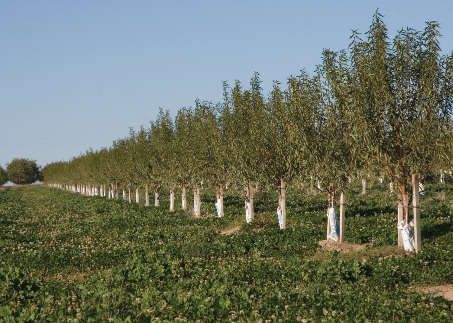
Windbreaks and shelterbelts consist of trees and shrubs planted in single or multiple linear rows with the purposes of reducing leeward wind speeds, controlling snow drifts, and providing shelter for farmsteads, livestock and wildlife. Historically, shelterbelts were considered to be wide windbreaks with ten to twenty rows of trees and shrubs, while windbreaks were smaller one to three row systems primarily meant to control wind erosion on agricultural lands. Today, some still make that distinction that shelterbelts protect farmsteads, livestock facilities, and wildlife, while windbreaks are primarily for cropland protection. However, NRCS uses the terms interchangeably in most areas of the country.
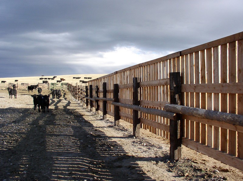
Windbreaks have long been considered a benefit to agricultural operations, via their ability to reduce wind speeds and control wind erosion, increase crop yields across protected fields, offer protection from blowing snow, serve as shelter for livestock from weather extremes, offer habitat for wildlife and pollinators, conserve soil moisture on fields by reducing evapotranspiration and sublimation of snowpack, and reduce energy needs around farmsteads. In the early 1900’s, President Theodore Roosevelt was convinced by previous work of the USDA’s Division of Forestry that tree reserves could be established on the Great Plains to offer timber resources to the developing area. He was also convinced that large-scale tree planting on the west edge of the Great Plains could affect higher precipitation to the eastern plains. By Executive Order in 1902, President Roosevelt subsequently created two forest reserves in the Sand Hills area of Nebraska, which at the time were mostly void of trees. These areas were later renamed the Nebraska National Forest, which to this day has the distinction of being the largest man-made forest in the United States.
The success centering around the Nebraska National Forest effort, and the establishment of several USDA forest nurseries capable of producing hundreds of thousands of tree seedlings annually, spawned President Franklin Roosevelt’s idea of creating a 100-mile wide shelterbelt across the Great Plains to address the Dust Bowl of the mid-1930’s. Although the 100-mile wide shelterbelt never came to fruition, Congress did enact the Cooperative Farm Forestry Act which paved the way for the Prairie States Forestry Project (PSFP). The PSFP was responsible for installing over 220 million trees between 1937 and 1942 in over 30,000 windbreaks that stretched from Texas to Canada. Many of these windbreaks still exist today, though a large percentage are in various states of disrepair.
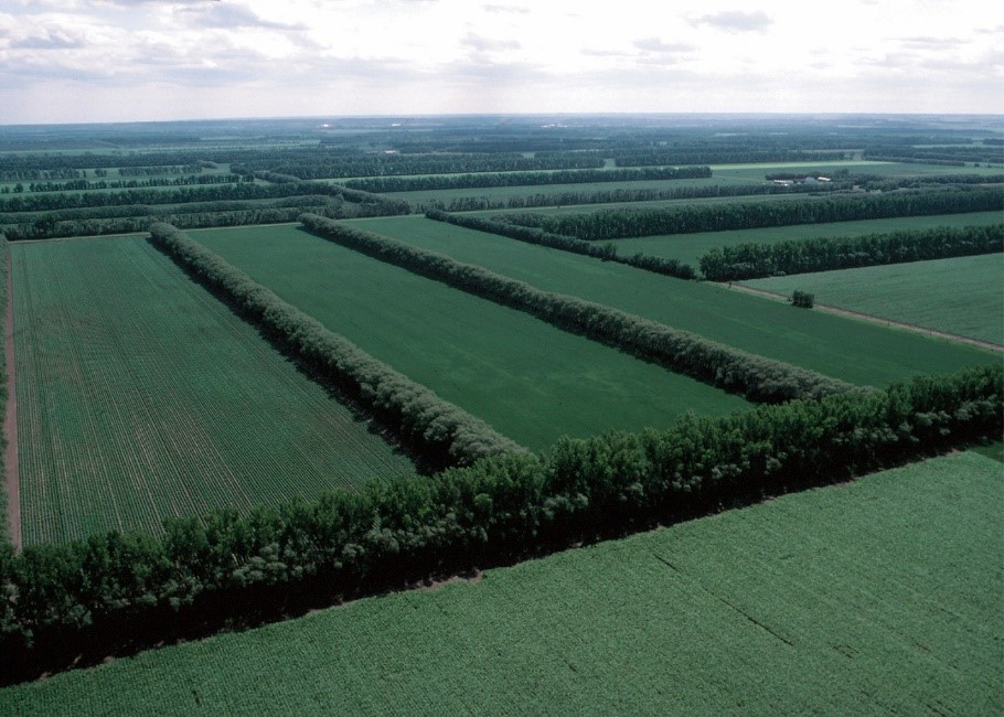
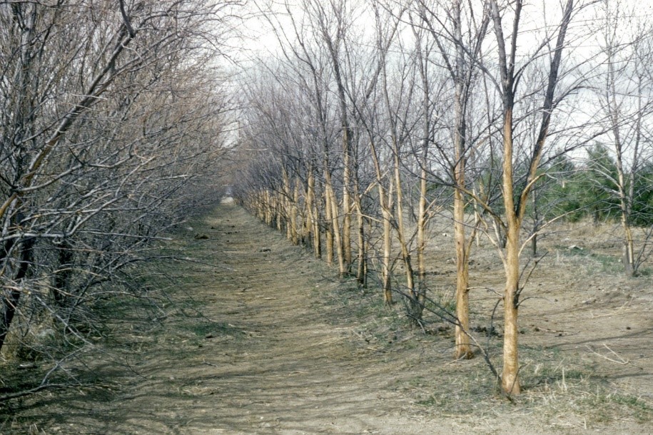
Windbreaks installed during the PSFP proved their value, and efforts of the Soil Conservation Service brought windbreak technology to other wind erosion problem areas across the western United States during the 1940s and 1950’s. However, since irrigation was required to maintain windbreaks in the arid west, these were not as robust as the oftentimes 20-row windbreaks installed under the PSFP. In fact, most irrigated windbreaks installed to this day in the west are single-rows of drought tolerant trees.
By the mid-70’s, irrigation was becoming commonplace on the Great Plains and reduced tillage systems were keeping more residues on the surface, thereby feeding the perception that windbreaks were no longer needed. Additionally, windbreaks were not compatible with center pivots and larger farm equipment, and many of the older windbreaks were in dire need of renovation. Consequently, many farmers began removing their decades-old windbreaks and shelterbelts. In 1975, the General Accounting Office and the USDA submitted a report to Congress requesting action to discourage removal of shelterbelts in the Great Plains. The report acknowledged that irrigation and newer conservation tillage systems were very effective at controlling wind erosion, but also stated that during severe drought windbreaks may be the only source of protection against wind erosion. It recommended that a cost-sharing renovation program be created, along with an education program that emphasized all the benefits of windbreaks. Furthermore, the report requested a survey to assess the status of existing windbreaks.
In response to this request, Iowa State University was commissioned to study windbreak removals and installations over a five-year period. This effort, which took place from 1970-1975 and included a five-state sampling area (North Dakota, South Dakota, Nebraska, Kansas, and Oklahoma), revealed that more windbreaks were installed than removed, although South Dakota and Oklahoma saw a net reduction in windbreaks. Also noted was a trend away from wide windbreaks, as the total area under windbreaks decreased by 2 percent.
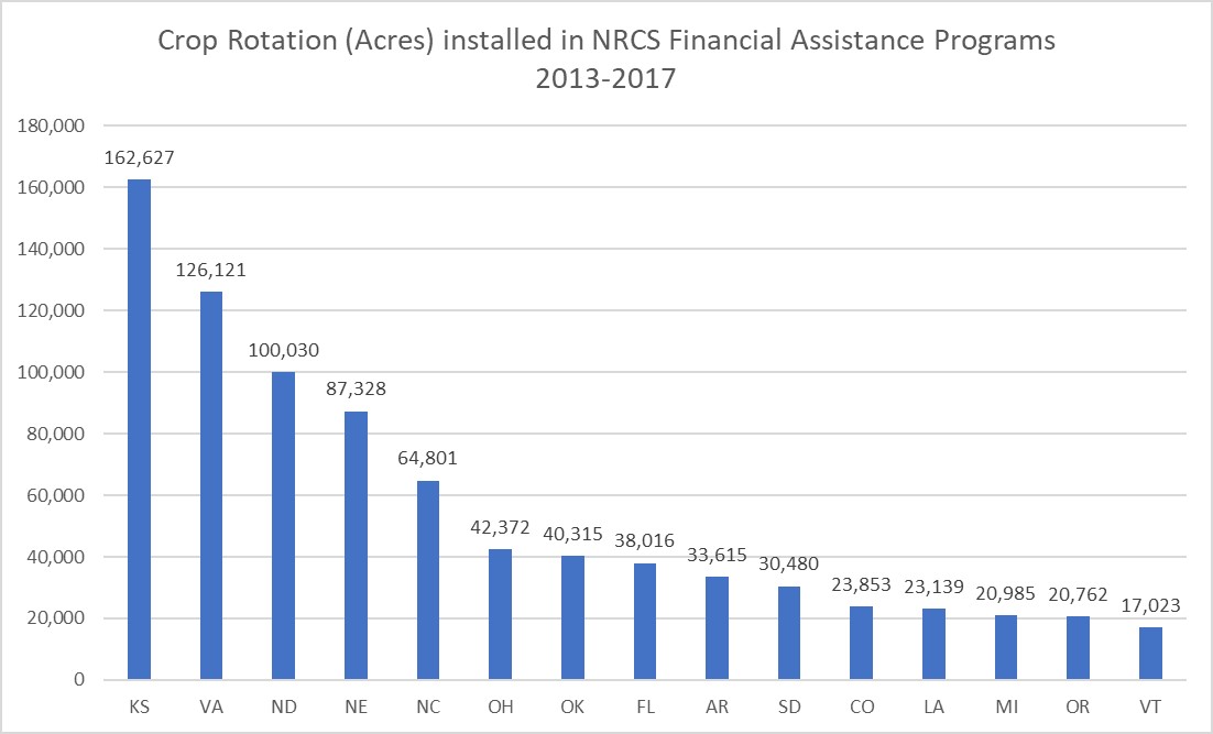
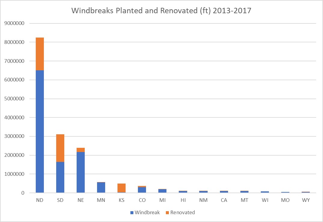
A more recent analysis68 shows a nearly 50% decline in both number and feet of windbreaks installed from 2006 to 2012 under the NRCS financial assistance programs. Conversely, during the same period, a nearly 400% increase in the number and feet of windbreak renovations has occurred, again through NRCS financial assistance programs. Figure 6-22 shows the top 14 states in implementing Windbreaks (380) and Windbreak Renovation (650) from 2013 to 2017.
The design of windbreaks is highly technical, and this may explain why some states, by a wide margin, install more windbreaks than others. A state’s historical connection with windbreaks may offer continuing specialized training opportunities to foresters, arborists, and conservationists who develop and maintain the necessary expertise to carry out a robust and persistent windbreak program. The disparity between states could also be attributed to frequency of weather events that drive the need and desire for windbreaks.
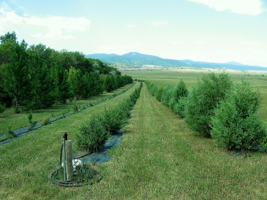
Windbreaks will typically have multiple objectives that must be considered when developing the design and layout. The planner must thoroughly examine the landowner’s intents and purposes, as these can inform subtle differences in design criteria. For example: are there concerns with crop protection, crop production and yields, wind erosion from a neighboring field, snow management, irrigation efficiency, water erosion, droughty soils, farmstead protection and energy use, protection of livestock loafing areas, aesthetics, screening of unsightly areas, maintenance requirements, noise reduction, wildlife habitat, salinity from salt application on adjacent roads, chemical drift, and/or carbon storage? The answers to these questions will determine tree/shrub selections, the number of rows and height of trees needed, density of plantings, the herbaceous component and management thereof, and orientation of the windbreak. Each state has developed a specification for design of windbreaks; North Dakota’s is one of the most comprehensive and is included in this handbook as Appendix B, Exhibit 6-6.
Most states where windbreak installation is common have also developed Conservation Tree and Shrub Groups (CTSG, but sometimes referred to as Windbreak Suitability Groups, WSG) that assist in selecting trees that are compatible with varied soil and climate conditions. These references are generally found in each state’s Field Office Technical Guide (FOTG).69 Formats for these reports vary widely from state to state; samples of these tools are included in Appendix B for Kansas (Exhibit 6-7), Nebraska (Exhibit 6-8), and Colorado (Exhibit 6-9). It is imperative to know the soils types for the site to utilize these tools. They can be found online at Web Soil Survey32 by selecting the area of interest in the online tool. Web Soil Survey typically will have the CTSG available under the “Suitabilities and Limitation for Use” tab listed under the “Land Classifications” section.
As a rule of thumb, windbreaks provide cropland protection from wind and erosion equal to a horizontal distance on the leeward side of the prevailing wind direction that is ten times the height of the tallest row in the windbreak. This can be highly variable, as it is based on the aerodynamics of the windbreak and heavily influenced by the porosity of the windbreak. Denser windbreaks tend to shelter a greater distance; however, excessively dense windbreaks create turbulence as the wind breaks over the top that can cause wind to be drawn down quicker. Regarding snow management, excessively dense windbreaks will cause large drifts leeward of the windbreak. Whereas, somewhat porous windbreaks will drop snow evenly over the field, thereby improving soil moisture management. For these reasons, a multiple-use windbreak will generally be designed with a density of 60 to 80 percent (porosity of 20 to 40 percent).
In the West where single-row windbreaks are commonplace, tree spacing and tree selection can result in a relatively porous windbreak that gives protection at much less than 10 times the height of the trees. Single-row windbreak’s greatest disadvantage can be attributed to the dichotomy of aesthetics versus functionality. The tendency is to select drought tolerant trees that grow tall, but as these trees mature, the lower limbs either die off naturally or develop a ragged, sparse appearance. If the objective is to reduce crop damage originating from erosion on an adjacent field, the farmer may be better served by selecting a low-growing tree that maintains its low-level density over its lifetime.
Generally, when looking at whole-field yields, windbreaks do improve average yields, and there have been many site-specific, tree-specific, and crop-specific studies that validate this.70,71 However, many studies will show decreased yields directly adjacent to the windbreak up to twice the tree height. This is due to shading and competition for water and nutrients. The yields gradually increase up to the protected distance, where yields will begin to diminish. To maintain reasonable yields adjacent to the windbreak, root pruning is generally completed every 5 to 10 years, but may require more frequent intervals depending on tree root growth.
As windbreaks age, normal annual maintenance should be expected to sustain the objectives and preserve aesthetics. This might include mowing the interspaces between rows, eradicating noxious or invasive weeds, reseeding pollinator beneficials, servicing irrigation equipment (if irrigated), and light pruning. However, major renovation of the windbreaks should be expected to be completed on 15-year cycles. The NRCS has developed a practice standard for Windbreak Renovation, and the practice is eligible for financial assistance in most states for NRCS’s financial assistance programs. Recognizing the value and legacy of windbreaks, many states have developed their own renovation programs available through their natural resources agencies or conservation districts.
Windbreak renovation consists of any single or combination of the following techniques: sod release (disrupting dense sod growth around trees with shallow cultivation), supplemental planting (adding new rows or replacing dead trees), coppicing (cutting shrubs and trees near ground level to encourage new growth), pruning, thinning of woody plants, row removal (generally older rows with many dead or decadent trees), and root pruning. Each state has developed a specification for more detailed guidance on each technique; North Dakota NRCS has developed an excellent example which is included in this handbook as Appendix B, Exhibit 6-10. Windbreak renovation can be very technical, and it is advised to solicit expert instruction from a local NRCS office, Cooperative Extension, Conservation District, or state forestry agency. Renovation of an existing windbreak can easily be more expensive than the original establishment, depending on the techniques needed.
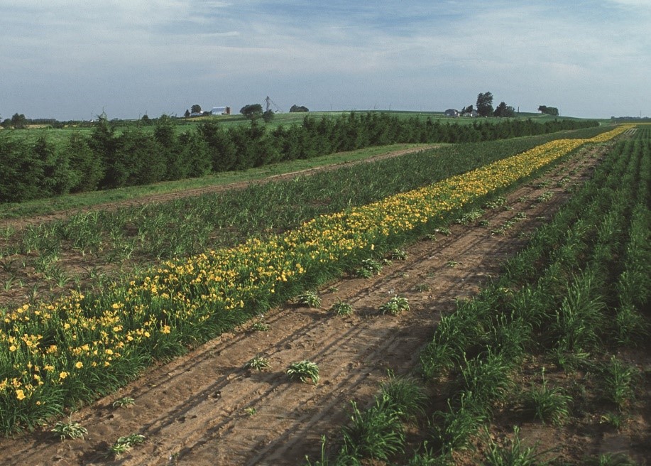
Hedgerow Planting – 422
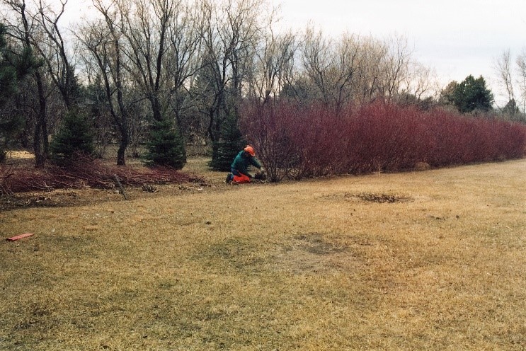
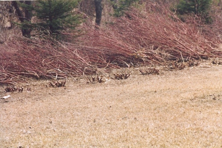
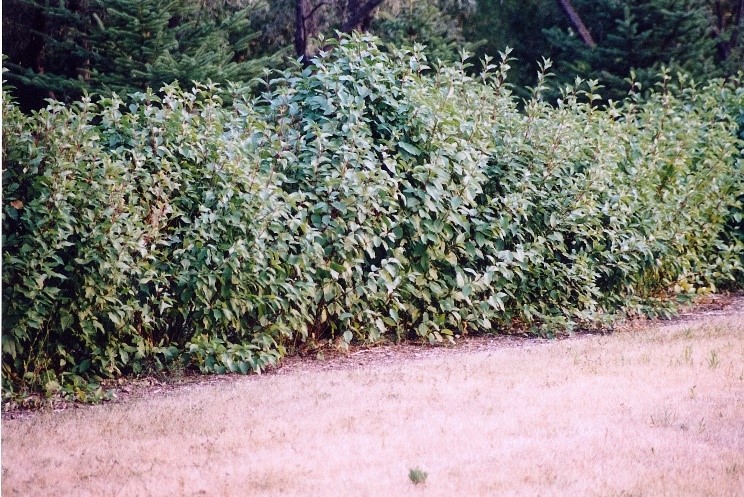
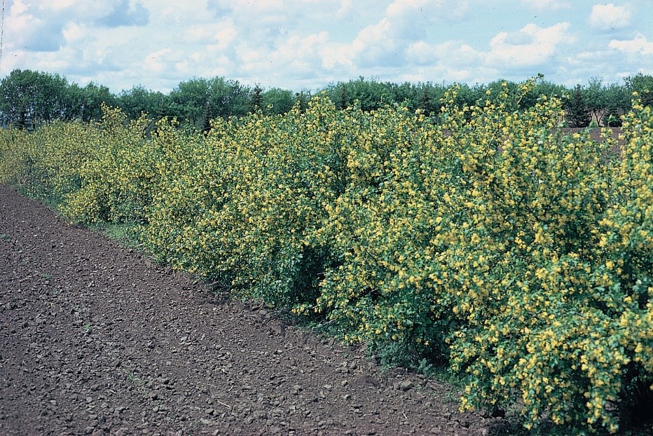
Hedgerows and windbreaks function similarly and have many of the same purposes and benefits. Like windbreaks, hedgerows can intercept airborne particulates, reduce chemical drift and odors, screen and provide barriers to noise and dust, provide food and cover for wildlife, provide pollen, nectar and nesting habitat for pollinators, provide substrate for beneficial invertebrates, and provide boundary delineation. Hedgerows differ from windbreaks in that they are narrower and shorter, and thus do not provide as much lateral protection from erosive winds. However, they can be very effective at intercepting aeolian sediment from adjacent fields. They are typically denser than windbreaks and can serve as a living fence, particularly when thorny shrubs are included in the species mix. They can be effective at excluding livestock and ungulate wildlife from sensitive areas. By NRCS standard, hedgerows must have a minimum mature width of 15 feet. From a historical context, hedgerows were often used a source of fuel wood due to their short stature and relatively rapid regrowth. Conventional heating of rural farmsteads has reduced hedgerow use for this purpose.
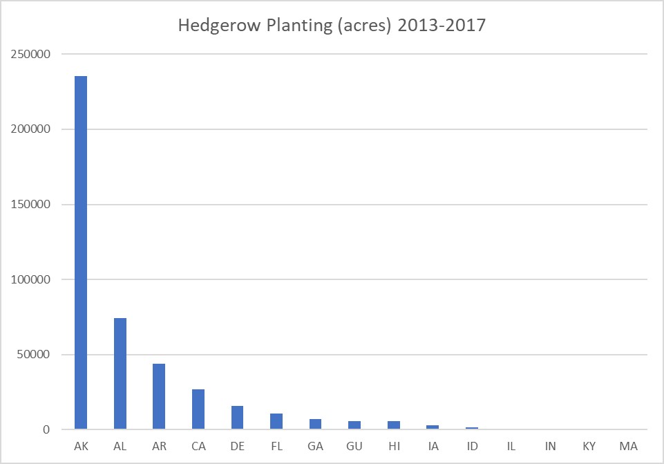
Hedgerows are widely utilized across the country. Thirty-three states and U.S. territories reported programmatic use of Hedgerows (422) during the years 2013 to 2017. Figure 6-31 shows the top 15 states and territories in implementing the Hedgerow Planting practice.
Mulching – 484
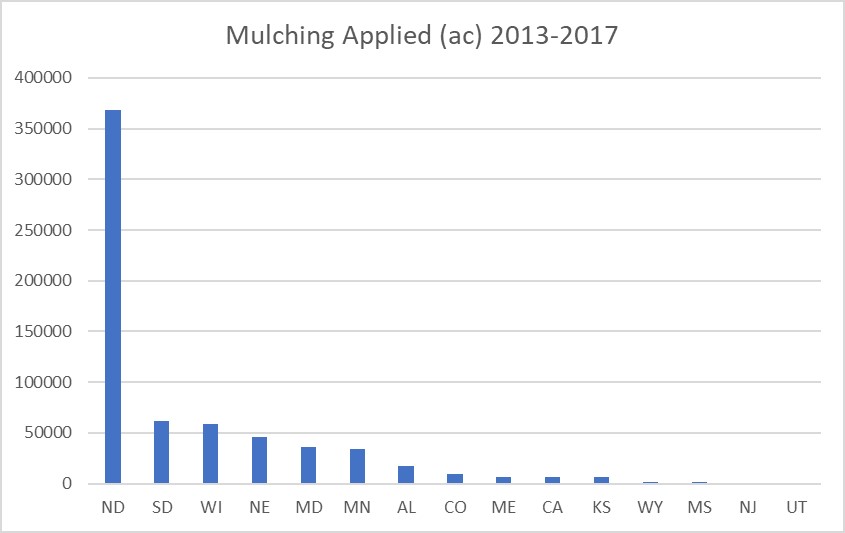
Mulching is the act of applying plant residues, compost, composted manures, wood chips, and other suitable materials to the land surface. Mulching (484) can be implemented on all land uses, although cropland is the predominant land use. This practice can be applied when associated to Critical Area Planting (342) to stabilize and restore vegetation after catastrophic fire, flooding or extreme erosion activity. More recently, this practice has been evaluated for its efficacy in controlling wind erosion and restoring severely degraded rangeland, as it performs similarly to crop residues left on the field. However, depending on the composition of the mulch, it too can be subject to blowing. Therefore, in non-cropland scenarios, mulches are commonly applied in combination with a tackifier, netting, or some other anchoring mechanism to keep the mulch in place. Hydromulchers and strawblowers are commonly used to distribute mulch in non-cropland land uses. Hydromulchers can distribute seed, fertilizer, mulch, tackifier and water in a single operation. The largest models can discharge the slurry up to 300 feet; strawblowers can distribute straw anywhere between 40 to 120 feet.
In cropland situations, fine fiber mulches are subject to blowing as well, which is why most fine fiber mulches are incorporated into the soil to some degree. This would include organic mulches and composted manure. In these cases, soil health and fertility may be the primary concern, with wind erosion abatement being a secondary benefit. The secret to organic mulches in controlling wind erosion is directly related to the soil-binding capability of decomposed organic matter- called humus. Humus is the glue that holds soil particles together, building soil structure responsible for the macro and micro pores that hold water and nutrients. These aggregated soils are more resistant to saltating soil particles.
Organic mulches can consist of a variety of plant-derived materials, including leaves, grass clippings, straw, tree clippings, bark, sawdust, seaweed, and the like. “Certified” organic mulch is guaranteed not to include products exposed to pesticides, inorganic commercial fertilizers, or other man-made chemicals. Certified organic mulch is highly sought by USDA certified organic producers. Almost all organic mulches generally include some type of animal manure that supplies nitrogen to the mix. The nitrogen is needed to feed the microorganisms that break the plant materials down to humus and useable nutrients. When manure is used as mulch, or as a component of the mulch mix, application rates should be in accordance with a nutrient management plan. The nutrient management plan will ensure nutrient levels do not exceed plant needs and be susceptible to leaching or runoff.
Woody materials have a high carbon to nitrogen ratio (C:N); thus, they break down slowly. An ideal C:N ratio for agricultural mulch or compost is 25 to 30:1. Mulches with higher ratios will take longer to break down, and soil microbes will then consume other plant-available nitrogen. This may cause a slowdown in crop growth due to nitrogen deficiency. Mulches with lower C:N ratios are quickly consumed by microorganisms, resulting in surplus nitrogen that can actually be counterproductive to healthy plant growth or simply be lost through volatilization or leaching beyond the root zone.
Large fiber mulches such as straw and wood chips are often used in orchard and vineyard alleys, as well as livestock loafing and bedding areas. They are effective in controlling wind erosion and keeping dust down when used in this capacity. They are less likely to blow away when left on the surface, but the land owner should be aware that they can float away in heavy rainfall, and should guard against drainages being blocked or plugged. Large fiber materials have a high carbon to nitrogen ratio and, if ever incorporated into the soil, a period of low nitrogen availability for crop growth may be realized.
Inorganic mulches include man-made materials (plastic sheeting, polypropylene sheeting, geotextiles, rubber, rock, gravel), and the conservation practice standard permits the use of inorganic mulches. Sheet mulches are used to control wind erosion and dust emissions when planting/growing specialty crops, human consumables, and windbreak establishment. Sheet mulches conserve soil moisture, protect seedlings from damaging wind erosion events, reduce weed competition, reduce dust deposition on vegetables, warm the soil faster, and provide a longer growing season, among other agronomic benefits. These benefits are particularly realized when planting windbreaks. Woven polypropylene sheeting is becoming the mulch of choice for windbreak planting due to its longevity, permeability and ruggedness.
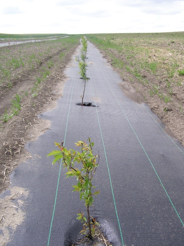
Figure 6-34 below shows the top 15 states in implementing the Mulching practice through the NRCS Environmental Quality Incentives Program (EQIP) program; there appears to be a significant association of this practice with windbreaks, when compared to the windbreak planting and renovation statistics shown in Figure 6-22.
Conservation Cover – 327
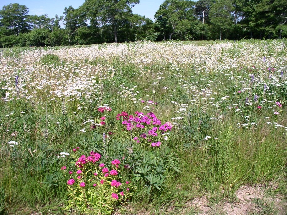
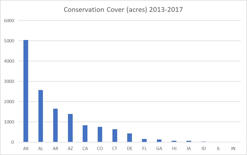
This practice is used to provide permanent vegetative cover to areas that would otherwise be exposed to erosion. The practice is designed to have a 5-year lifespan, and only minimal harvesting of any vegetative matter is permitted (only to the amount that the purpose is not compromised), unlike Cover Crop which is seasonal and allows harvest for livestock forage. Typically, Conservation Cover (327) is utilized in pivot corners or other associated agricultural areas that are oddly-shaped, small, have production issues, or are otherwise difficult to farm. These areas are commonly planted with vegetation that enhances wildlife habitat, pollinators, or other beneficial organism that facilitates Integrated Pest Management. Although native plants are not required as part of the seeding mix, the practice standard does give strong consideration for the use of native plant materials.
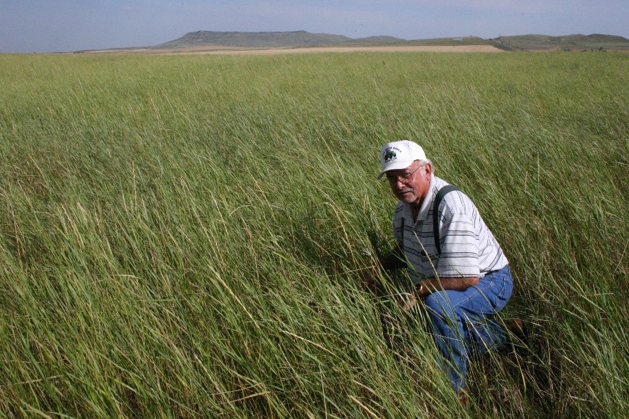
The USDA Farm Service Agency (FSA) administers the Conservation Reserve Program (CRP). Although FSA does not follow NRCS practice standards for the CRP, the CRP does have definitions for several practices that are consistent with the NRCS Conservation Cover practice standard, including CP-1 - Introduced Grass and Legume Establishment, CP-2 – Native Grass, Forb and Legume Establishment, CP-4D – Permanent Wildlife Habitat. Farm owner Alan Honeyman of North Dakota, a CRP program participant, stated, “Before CRP, we used to have dust storms in the spring, which have now abated." Water quality has also improved. But most of all, Alan noted, "We have created wildlife habitat that has repopulated game birds."72
Field Border – 386
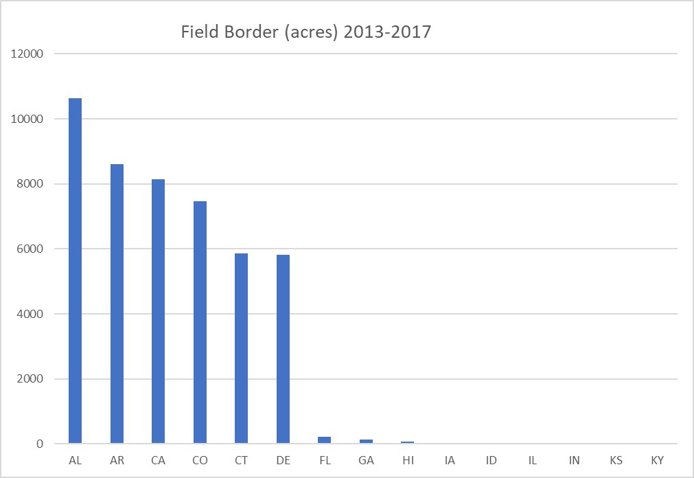
Like Conservation Cover, Field Borders (386) are designed as permanent perennial vegetation to control soil erosion. However, Field Borders are designed for a life expectancy of 10 years, compared to Conservation Cover’s 5-year expectancy. To control wind erosion, field borders are installed on the field edge that would give the most protection from prevailing winds during critical wind erosion periods for the crops grown. They can be planted on a single field edge or along multiple edges. For wind erosion purposes, the vegetation should provide a dense cover, with the minimum height of vegetation being one foot and made up of plant materials with stiff, rigid stems that disrupt creep and saltation and trap airborne sediments. Field Borders are oftentimes installed to address a wind erosion problem originating from an adjacent field or degraded area. Most Field Borders are approximately 30 feet wide, but they should be wide enough to control erosion. Vegetation can be single species or a mix; mixed species field borders are better suited to address multiple purposes, e.g., pollinators, wildlife habitat, etc. Most states have a vegetation planting guide that will identify which vegetative species are best suited for Field Borders specific to soil and site conditions. Field Borders are widely utilized across the country; they have been installed in 44 states and U.S. territories in NRCS financial assistance programs during the period from 2013-2017. This practice has multiple purposes and is more likely to be installed for water erosion and water quality concerns in Eastern and Southeastern states where average annual precipitation exceeds 35 inches.
Herbaceous Wind Barrier – 603 and Vegetative Barrier – 601
Both Herbaceous Wind Barrier (603) and Vegetative Barrier (601) are composed of stiff, erect vegetation planted in a row (or rows). They can appear similar on the landscape, with the exception that Vegetative Barriers will most likely be placed on steeper slopes. However, these two practices have separate purposes: Herbaceous Wind Barriers are associated to a wind erosion, while Vegetative Barriers are installed to address sheet and rill erosion. This difference leads to dissimilar design and layout considerations. Because of their similar composition, both practices will show a positive effect for wind erosion in the Conservation Practice Physical Effects (CPPE). Nevertheless, Vegetative Barrier is purposed to address sheet and rill erosion, and thus should not be considered to address a wind erosion concern and is not further discussed here.
As noted, Herbaceous Wind Barriers are composed of relatively dense, erect, stiff vegetation that is resistant to lodging and can withstand blowing soil particles and the resultant deposition of soil at the base of the plants. They are intended to be a 5-year practice with perennial vegetation. However, annual plants are permitted by the practice standard, which then would require annual replanting and renovation of the barrier. Since the practice has a 5-year lifespan, financial assistance through NRCS programs would be limited to a 5-year cycle.
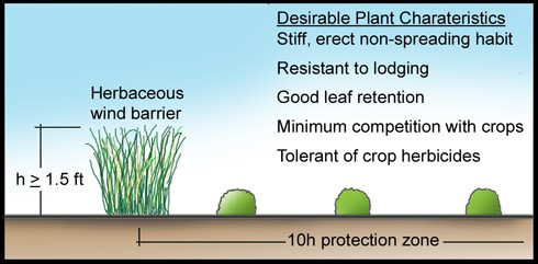
Like windbreaks, Herbaceous Wind Barriers provide soil protection up to ten times their height when planted perpendicular to the prevailing winds. Therefore, to adequately protect a field with this practice, multiple rows of barriers would be planted across the field at roughly 10 times the expected height of the barrier. Barrier interval spacing must give consideration to the width of farm equipment used in the cropped area.
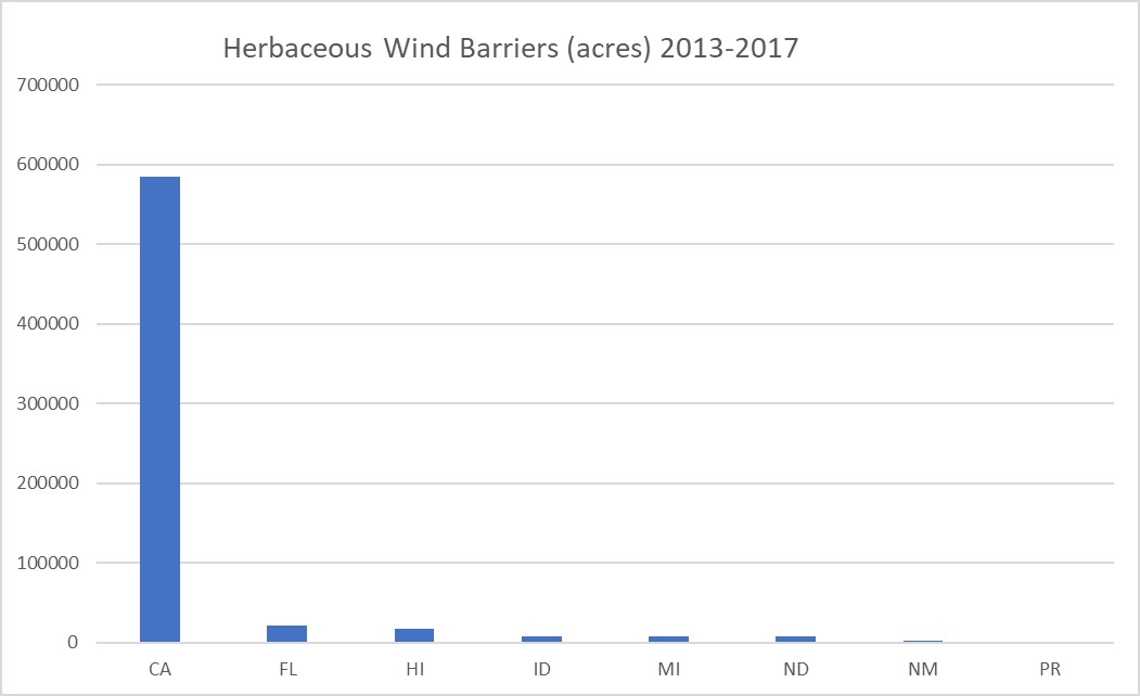
Herbaceous Wind Barriers are not widely practiced across the country. In fact, only seven states and one U.S. territory reported any activity with this practice during 2013 to 2017. Figure 6-43 shows where this practice is being implemented with NRCS financial assistance programs. It can be suggested that this practice is perhaps best applied in coastal areas where droughty sandy soils are prone to blowing, as indicated by its presence in California, Florida and Hawaii as well as Puerto Rico (PR).
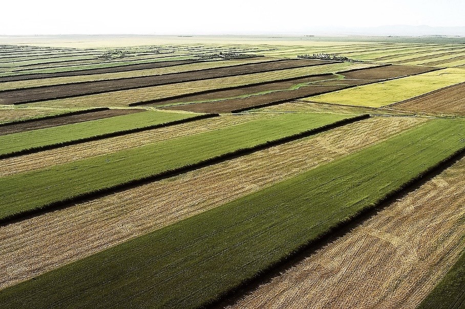
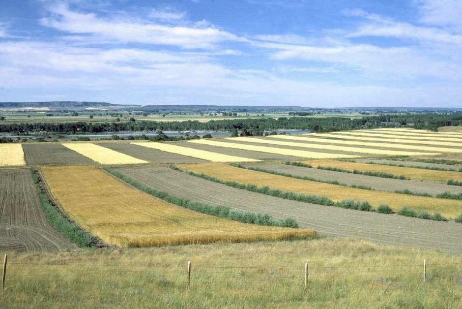
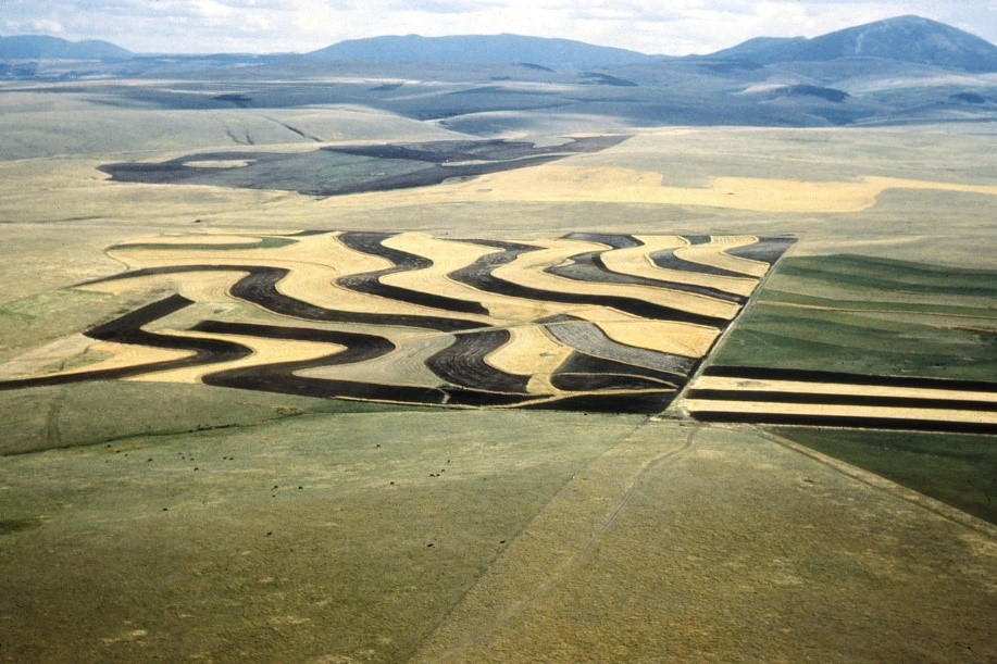
Stripcropping – 585
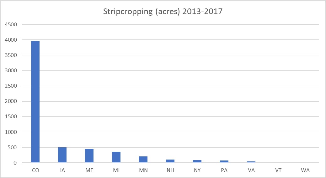
Stripcropping (585) is defined as the growing of planned rotations of erosion-resistant and erosion-susceptible crops or fallow in a systematic arrangement of strips across a field. Erosion-resistant crops are considered to be close-growing crops such as grain or forage. This practice can be used to address wind erosion or water erosion. For wind erosion purposes, at least half of the field in consideration will be planted to the erosion resistant crop in alternating strips. The width of the strips will be designed as such that the WEPS computes an average erosion rate for the field to be less than T (soil loss tolerance for the soils on the field). Historically, Stripcropping was commonly applied across the country, particularly from the 1950’s through the 1970’s, and picturesque scenarios were commonplace over thousands of contiguous acres. However, as other forms of erosion technology came online in the 1970’s, namely reduced tillage systems, Stripcropping began to wane. Only eleven states had reportable activity during the 2013-2017 period through NRCS financial assistance programs (Figure 6-47). Even Colorado, which far exceeded any other state’s adoption, installed only slightly less than 4000 acres during this five-year period.
Multi-story Cropping – 379
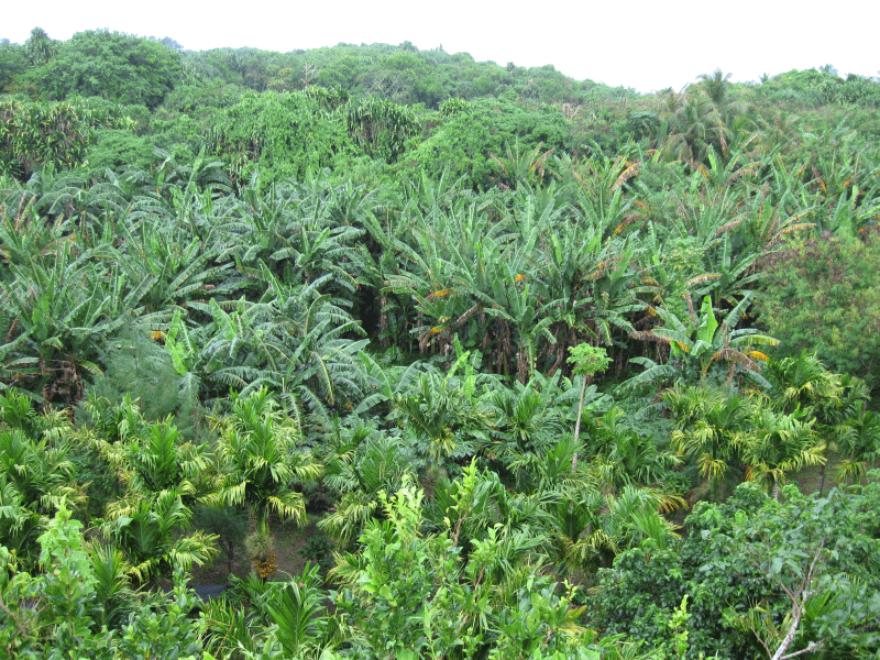
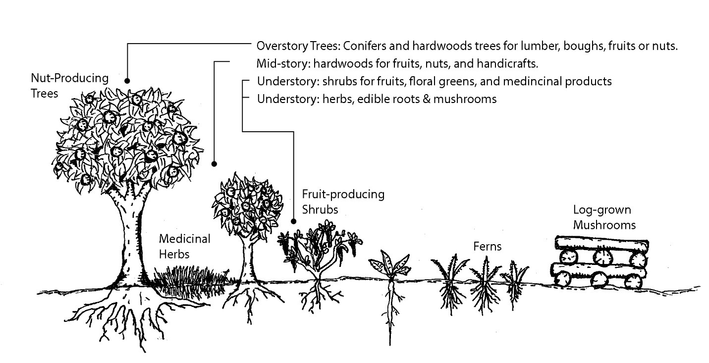
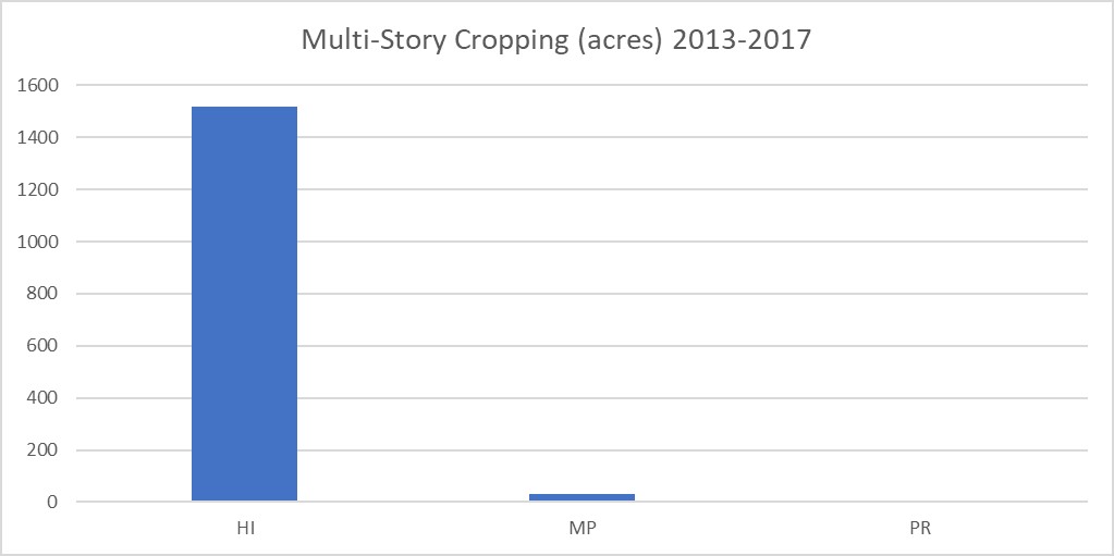
Multi-story Cropping (379) is defined as existing or planted stands of trees or shrubs that are managed as an overstory, with an understory of woody and/or non-woody plants that are grown for a variety of products.74 This practice can be compared to windbreaks, as there is a tree component whose effect will reduce wind speeds and provide protection to cropped fields planted on the leeward side of the prevailing wind direction. However, they are different from windbreaks in that there are oftentimes no discernable rows of trees and shrubs, and most often every vegetative component (story) has a harvestable commodity. Also, the trees may be a native stand that is augmented with mid- and understory crops. This practice currently applies only to tropical islands, for example Hawaii, as shown in Figure 6-50, and is commonly used in small farm and/or subsistence farming operations. Because of the intermixed species, harvest is not typically mechanized for any of the crops. Thoughtful planning of the various crops can space harvest labor over an extended period.
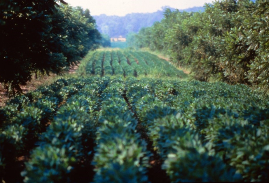
Alley Cropping – 311
Alley cropping is the process of growing harvestable crops between rows of trees or shrubs. Typically, the trees are considered the primary crop (nuts, fruit, or wood products), while crop production between the trees is secondary (forage, horticultural, or agricultural products). However, it can be reversed, where the trees are secondary and supply protection from erosion and other environmental elements to the primary crop. In either case, the compatibility of the crops should be explored, particularly with regard to plant pests and disease that could be transferred from one crop to the other.
When trees are young, successful implementation of alley cropping is relatively simple. As the trees age and their root systems and canopies expand, competition for light, water, and nutrients will become apparent, thus crop selection decisions should include management implications. In scenarios where the trees are secondary, root pruning and canopy reduction will likely become necessary. Root pruning should be started early while the trees are young to train the roots to grow deep rather than laterally, and continued annually or biennially. If it is known at the time of planting that the trees will be the secondary crop, planting the trees at a wider row spacing can reduce competition while not impairing the protection qualities of the trees. In scenarios where the tree crop is primary, tree canopy will likely eventually shade a significant portion of the interspace, and production of the herbaceous crop must shift to shade tolerant species, of which there are far fewer to choose from.
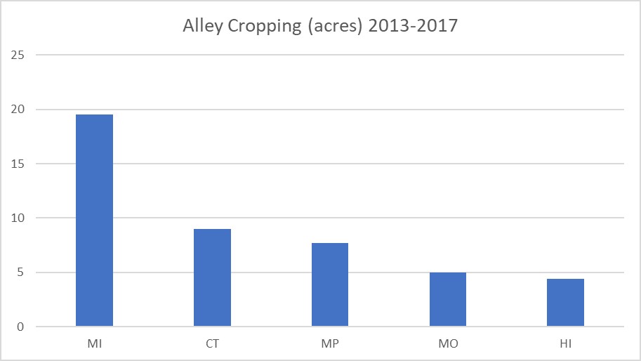
Alley Cropping (311) has limited use in NRCS financial assistance programs, as evidenced in Figure 6-52 below. Only four states and one U.S. territory reported any activity during 2013-2017, and participation appears limited to small acreage farms, with particular interest in the Pacific Basin (Hawaii and the Marianas Islands [MP]). NRCS considers the lifespan of this practice to be 15 years. Program participants are expected to maintain any cost-shared practice for the expected lifespan. This may underpin the unpopularity of this practice, as growing annual crops between rows of trees is likely an annual operational decision.
Field Operations Emissions Reduction – 376
This practice is designed specifically to reduce particulate matter emissions resulting from routine field operations, which might include planting, harvesting, or tillage. As such, it is principally considered an air quality practice. Although primarily purposed for cropland, this practice also applies to activities on rangeland, pastureland, and forestland. Since excessive trips across a field disturbs the soil, there is an increased likelihood of creep and saltation. Thus, the practice has air quality and wind erosion benefits. Also, the premise of this handbook is to include dust abatement practices.
Dust emissions can be mitigated by combining operations in a single trip across the field, utilizing water or other chemicals designed to keep particulates from getting airborne, using precision agricultural equipment to reduce overlap, increasing equipment size to reduce the number of trips across the field, timing operations to avoid weather conditions that promote emissions, or completing other field operations that limit the opportunity for dust to become entrained in the air column. Where air quality is a concern – such as fields adjacent to residential areas, schools, churches, etc., when PM10 exceeds standards, or adjacent to major transportation corridors – this practice should be considered.
During the evaluation period of 2013 to 2017, California was the only state to implement this practice.
Amending Soil Properties with Gypsum Products – 333
This practice has no direct purpose associated to wind erosion; rather, the practice’s main purposes are to address soil properties related to fertility, health, productivity, and permeability. There is a possible benefit to wind erosion and dust abatement when soil quality is negatively impacted with excessive salinity and sodium. An imbalance of sodium, and to some degree potassium, ions with calcium and magnesium ions can deflocculate soil aggregates to the point that water penetration into the soil profile is seriously impaired. Over time, the lack of hydraulic conductivity through the soil profile can promote salt accumulation in the upper horizons. This results in an area that has high salinity and sodium content, which tends to raise the pH of the soil. High pH can limit the availability of some key macronutrients. The combined effects of high salinity, low available water, and limited nutrient availability can lead to an area devoid of vegetation. These areas are susceptible to wind erosion and the blowing soil particles can damage and disrupt the development of nearby growing crops.
Application of gypsum (calcium sulphate) can ameliorate the negative effects of excess sodium in the soil, whereby mass exchange of sodium with calcium on the exchange sites of soil colloids allows the sodium to bind with the sulphate anion and leach from the soil profile. Once the sodic condition in the soil is corrected, water can easily infiltrate the soil surface, vegetation can be established, and a reduction in wind erosion will be realized. Sodic and saline-sodic conditions can also be found on rangeland, and treatment of these areas with gypsum products is normally not considered for economic reasons.
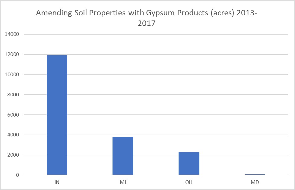
Only four states had reportable activity with this practice through NRCS programs in the years 2013 through 2017 (Figure 6-54).
Cross-Wind Trap Strips – 589C
Cross-Wind Trap Strips (589C) consist of herbaceous cover established in one or more strips typically perpendicular to the most erosive wind events. The vegetation can consist of annuals or perennials, growing or dead. The width of the strips is dictated by the height of the vegetation. Where the vegetation is less than one-foot tall, minimum strip width must be 25 feet or greater. Where the vegetation exceeds a height of one foot, then the strips must minimally be 15 feet wide.
Cross-wind trap strips are most effective when planted perpendicular to the prevailing wind direction during critical wind periods. This practice would typically be implemented on fields with problem soils or when a crop rotation leaves the field vulnerable to wind erosion during critical periods. When implemented, it is common for the selected vegetation to have a wildlife benefit. This practice should be a consideration for temporary water shortages on irrigated lands where whole fields may need to be fallowed for an extended period of time.
This practice was not utilized nationwide in NRCS financial assistance programs during the evaluation period of 2013 to 2017. Presumably, the practice has fallen out of favor because its implementation requires a substantial amount of land to be taken out of crop production.
Cross-Wind Ridges – 588 and Surface Roughening – 609
These practices are typically classified as emergency tillage and employed as a last-ditch effort to control wind erosion on susceptible fields. Both of these practices utilize the same principles: introducing roughness to the soil surface to increase friction, thereby slowing wind speeds down at the ground surface. Also, these practices interrupt the creep and saltation processes. Many states or local governments have dust ordinances that require emergency tillage be practiced when fields are susceptible to blowing dust. These practices can be implemented as it becomes evident a problem exists.
Cross-Wind Ridges (588) are constructed perpendicular to prevailing wind direction with some type of tillage equipment that forms ridges and furrows. Varied types of tillage equipment can serve the purpose, including listing equipment (bedding up), chisel plows, border disks, or seed drills with hoe openers. Cross-wind ridges are best utilized in sandy soils.
Surface Roughening (609) is designed to introduce large clods to the soil surface. Surface roughening implements can include heavy disks, rippers, chisels, or any equipment that forms large clods on the soil surface. Spacing and depth of the individual rippers, chisels, etc. must be considered to get optimum performance of the treatment. Too narrow of a spacing will tend to pulverize the surface, potentially nullifying its effectiveness, and it must be set deep enough to bring up large clods. This practice is best utilized on fine textured soils capable of establishing stable clods.
Neither of these practices should be considered as a primary approach to wind erosion control, and preferably they should be applied with other companion wind erosion practices. They are considered temporary practices, as wind and blowing soil particulates eventually wear down the clods and ridges and reduce their effectiveness. Oftentimes, the treatment needs to be reapplied before the wind erosion period is over.
References
32. Web Soil Survey. https://websoilsurvey.sc.egov.usda.gov/App/HomePage.htm.
54. Roth GW. Crop rotations and conservation tillage. Conserv Tillage Ser. 1996;1.
55. Campbell B, Chen L, Dygert C, Dick W. Tillage and crop rotation impacts on greenhouse gas fluxes from soil at two long-term agronomic experimental sites in Ohio. J Soil Water Conserv. 2014;69(6):543-552.
56. 2017 Census of Agriculture. United States Department of Agriculture National Agricultural Statistics Service; 2019. https://www.nass.usda.gov/Publications/AgCensus/2012/Full_Report/Volume_1,_Chapter_1_US/usv1.pdf. Accessed July 22, 2019.
57. 2012 Census of Agriculture. United States Department of Agriculture National Agricultural Statistics Service; 2014. https://www.nass.usda.gov/Publications/AgCensus/2012/Full_Report/Volume_1,_Chapter_1_US/usv1.pdf. Accessed July 22, 2019.
58. Marshall E, Maguire KB, Hellerstein D, Schimmelpfennig D. USDA ERS - Conservation Trends in Agriculture Reflect Policy, Technology, and Other Factors. https://www.ers.usda.gov/amber-waves/2019/august/conservation-trends-in-agriculture-reflect-policy-technology-and-other-factors/. Accessed September 9, 2019.
59. Claassen R, Bowman M, McFadden J, Smith D, Wallander S. Tillage Intensity and Conservation Cropping in the United States. United States Department of Agriculture Economic Research Service; 2018:27. https://www.ers.usda.gov/webdocs/publications/90201/eib-197.pdf?v=1783.8.
60. Vigil MF, Nielsen DC. Winter Wheat Yield Depression from Legume Green Fallow. Agron J. 1998;90(6):727. doi:10.2134/agronj1998.00021962009000060002x.
61. Cover Crop Economics Tool Version 2.1 (XLSM). https://www.nrcs.usda.gov/wps/PA_NRCSConsumption/download?cid=nrcseprd385824&ext=xlsm.
62. USDA Natural Resources Conservation Service. Cover Crop Economics. https://www.nrcs.usda.gov/wps/portal/nrcs/detail/null/?cid=nrcseprd385825. Accessed July 23, 2019.
63. 2020 Cover Crops Crop Insurance, Cover Crops and NRCS Cover Crop Termination Guidelines | RMA. https://www.rma.usda.gov/News-Room/Frequently-Asked-Questions/2020-Cover-Crops-Insurance-and-NRCS-Cover-Crop-Termination-Guidelines. Accessed July 23, 2019.
64. Cover Crops | RMA. https://www.rma.usda.gov/en/Topics/Cover-Crops. Accessed July 23, 2019.
65. Cover Crop Chart: USDA ARS. https://www.ars.usda.gov/plains-area/mandan-nd/ngprl/docs/cover-crop-chart/. Accessed July 23, 2019.
66. USDA Natural Resources Conservation Service. Pacific Northwest Cover Crop Selection Tool, Ver. 7.3. https://www.nrcs.usda.gov/wps/PA_NRCSConsumption/download?cid=nrcseprd894839&ext=zip.
67. Pacific Northwest Cover Crop Selection Tool | NRCS Plant Materials Program. https://www.nrcs.usda.gov/wps/portal/nrcs/detail/plantmaterials/technical/toolsdata/plant/?cid=nrcseprd894840. Accessed July 23, 2019.
68. Wight B. United States National Windbreak Perspective. Conference Presentation presented at the: Great Plains Windbreak Renovation & Innovation Conference; July 24, 2012; International Peace Garden.
69. USDA NRCS. Field Office Technical Guide. https://efotg.sc.egov.usda.gov/#/. Accessed July 23, 2019.
70. Controller General of the United States. Action Needed to Discourage Removal of Trees That Shelter Croplands in the Great Plains. United States Department of Agriculture; 1975.
71. Kort J. Benefits of windbreaks to field and forage crops. Gt Plains Agric Ie Agric Counc Publ USA. 1986;(117):53-54.
72. USDA Farm Service Agency Conservation Success Stories. https://www.fsa.usda.gov/FSA/printapp?fileName=ss_nd_artid_751.html&newsType=crpsuccessstories. Accessed July 30, 2019.
73. Bentrup G. Conservation Buffers: Design Guidelines for Buffers, Corridors, and Greenways. USDA National Agroforestry Center; 2008. https://www.fs.usda.gov/nac/buffers/index.html. Accessed July 29, 2019.
74. USDA Natural Resources Conservation Service. Practice Introduction – Multi-story Cropping, Code 379. November 2008. https://www.nrcs.usda.gov/Internet/FSE_DOCUMENTS/nrcs143_026600.pdf.
75. Agroforestry | NRCS Washington. https://www.nrcs.usda.gov/wps/portal/nrcs/detail/wa/technical/ecoscience/agronomy/?cid=nrcseprd1178607. Accessed July 29, 2019.